Nothing seemed too different when I crossed the border from Colombia to Ecuador. It was still green hills everywhere. Before long I reached Tulcán, the first major city on the main road to Quito. A well-attended local festival was in full swing, with the main event being one parade followed by another down the main street. I never got to figure out what the celebrations were about, thanks to my perfectly incoherent Spanish. I at least did manage to get directions to the nearest bank! Ecuador uses US Dollars as its currency (it replaced the Sucre), so the biggest change for me was adjusting to the new exchange rate. I'd been stuck on Colombian Pesos for six months, where 2500 Pesos were the equivalent of one Dollar. It took a couple days for it to sink in…
 |
| The green rolling hills of northern Ecuador, as seen from Road 35. |
 |
| One of a number of figures at a roundabout, Tulcan. |
After escaping the crowded streets I pushed on. In San Gabriel I managed to find what seemed to be the town’s only hotel, to enjoy my first night in Ecuador in luxury. Finding a wild camping spot seemed like a challenge in the rather open countryside, a challenge I was too lazy to take on. There would always be another day for camping!
 |
| The view from the hotel in San Gabriel. |
 |
| A mammoth beside my bike! Paleontological museum, Bolivar. |
After my birdingless rush through southern Colombia, I had not got around to flipping on my birding switch in Ecuador. I knew there were a few nice sites along the way to Quito, but most of them were off the main route. I again did not have the time to spend wandering about too much, so chose to stay on the beaten track, Road 35.
On the second day the road dropped down into a massive river valley, accompanied by a complete change in scenery. The lush pastures gave way to a drier scrub-like habitat, very reminiscent of the Little Karoo in South Africa. I almost felt at home! Despite the long wait at the roadworks, I thoroughly enjoined this part of the route. Just when I though it might last, I was back in the green rolling hills. And with that my homesickness subsided. My mind was also occupied with thoughts of finding a place to spend the night, sometimes the greatest challenge facing a touring cyclist. It was well after sunset when I eventually found a hard-earned camping spot beside a sugar cane field. It’s a rather huge relief to find two solid and well-spaced trees that can accommodate a simple device such as a hammock.
 |
| View from the top of the massive river valley. |
 |
| The bottom of the valley. Note the more arid terrain of the mountains. |
 |
| Some elegant wall art along the way. |
 |
| A great day for cycling! Getting closer to Ibarra. |
The next day held the promise of some birding. I was heading for the city of Ibarra, but would encounter an Andean lake called Laguna Yahuarcocha on the outskirts. I had also got wind about an official camping site overlooking the lake, so what more could I ask for? A few new bird species to add to the list and a warm shower! A pair of Harris’s Hawk circled above me, with their obviously rufous underwing coverts, followed by a male Ash-breasted Sierra-finch. The lake held the usual waterbirds such as Great Egret, Black-crowned Night-heron, Pied-billed Grebe, Blue-winged Teal, Andean Duck, and Neotropical Cormorant. Some more firsts for me were Andean Coot, Yellow-billed Pintail and a solitary Andean Gull. An Osprey was also seen making its way across the lake. Strikingly beautiful male Vermilion Flycatchers were rather common along the lake's shores, even perching in the reedbeds. Spotted Sandpipers were also about on the edges of the reeds, while I hoped in vane for a glimpse of an Ecuadorian Rail, known to inhabit the reedbeds at this lake. My hopes of seeing a Subtropical Doradito were also dashed.
 |
| The tranquil scene at Laguna Yahuarcocha upon arrival. |
 |
| Not the herons I was hoping for, but then I did see the real thing too. |
It turns out this lake has a dark past. Yahuarcocha translates to ‘blood lake’ in the Quechuan language, owing to the colour of the water after the domineering Inca’s massacred the indigenous Cayambe people there in the 15th Century. I’ll skip the rest of the details.
These days the lake presents an exquisitely peaceful scene; locals relaxing about the shores, some fishing the shallows, cyclists and joggers taking to the circumnavigating road. I took this road as well, from which to spot birds instead. Towards the back end is where I found ‘Finca Sommerwind’, the camping ground that I had been tipped off about. Perfect spot for a camp site, with the mountain slope rising up directly behind it. The German owners were very welcoming and I was soon meeting up with the other travelers, also German. A dinner party was arranged for the second night, so I opted to stay longer and brush up on the language again.
 |
| Fishermen at Laguna Yahuarcocha. Camping was at the opposite end of the lake. |
 |
| The reception and restaurant all in one at Finca Sommerwind. |
 |
| Preparing for dinner at Finca Sommerwind. |
 |
| View over the city of Ibarra, northern Ecuador. |
The lake did not reveal any new species for me the next day, but the splendid scenery made up for the lack of additional lifers. Satisfied, I was on the road again to close the gap with Quito. South of Cayambe I made a stop at Quitsato, the sun dial on the equator. This is the middle of the earth and so I enjoyed the novelty of moving from the Northern to Southern Hemisphere in just a single step. Could anything be more entertaining? Probably. I spent well over an hour here, taking a break from the cycling and enjoying the sunshine.
 |
| I could not resist a photo of these intensely blue-coloured dolphins in Ibarra. |
 |
| Water melons for sale, and grilled corn. |
 |
| Satisfy your soul; what else needs to be said? |
 |
| My second night of wild camping in Ecuador. |
 |
| Well hello! A cicada that took shelter under my shirt for the night. |
 |
| Sign post at the Equator - the middle of the world. |
 |
| Information board at the Quitsato sun dial. |
 |
| Yep, all zeros for the latitude reading - this must be the Equator! |
 |
| A weary traveler at the Equator, beside his vintage and trusted bike! |
 |
| Freedom of the open road! Heading south from Cayambe. |
I then made the most fabulous discovery yet since arriving in Ecuador. Well, I did not discover it myself actually, but was again tipped off. But the thing is, it took me a while to find it so in the end it felt like a self-made discovery. And that is the El Chaquiñán cycle route, an old disused railway line between Quito and Ibarra to the north. And I am not the first to say that it is a wonderful discovery, you can read a more detailed review by 'Crazy Guy on a Bike'. He also had fun along this route, but luckily for him, he rode all 70 km of it, from Cumbaya (close to Quito) to Cayambe (it possibly goes still further north).
 |
| Map of the El Chaquiñán cycle route, from Puembo to Cumbaya near Quito. |
 |
| There are numerous such portals along the route, with a security guard! |
I heard about it only upon my arrival in Yaruqui, which is close to the Puembo portal (see the photographed map above). I had to use Google Maps and a little luck to actually find the portal to access the route here. Apparently the majority of the route from Puembo northwards to Cayambe is not in the best shape (and also not sign posted), so a mountain bike would be the recommended mode of transport for this section. However, the 18 km or so from the Puembo portal (coordinates: -0.179925,-78.360334) to the Cumbaya portal (-0.199545,-78.431482) is well maintained and I am pleased I had the chance to ride it. Highly recommended! Firstly, it was previously a railway line so it follows the contours making for easy riding, and secondly, it passes through the spectacular Chiche River valley. So don’t miss out on this one if you are heading for Quito by bike! Take note that once you reach the Cumbaya portal and exit the cycle route, you are on your own finding the way into Quito city. I took the most direct route via a suburb called Guapulo; it was most likely the shortest, and probably the steepest!
 |
| View over the Chiche River valley from the cycle route. |
 |
| Entrance to a long and dark tunnel. |
 |
| Looking back through the tunnel. Note the nearly buried railway line. |
 |
| And there was light at the end of the tunnel! |
 |
| A few smaller tunnels and 15 km left to go to Cumbaya. |
 |
| Looking back across the valley to the tunnel entrance, marked with an arrow. |
 |
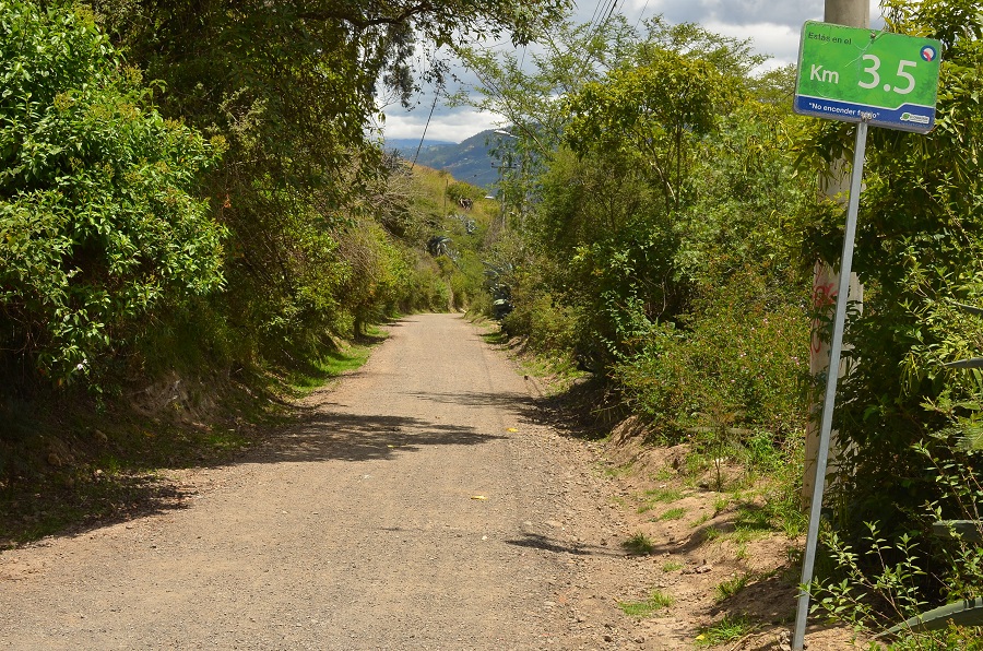
| Almost there, just 3.5 km to the Cumbaya portal. |
 |
| At the Cumbaya portal after a fantastic ride. |
Once in Quito, I made plans for the next trip, and also the last…My apologies for passing on no earlier warning, but my plan for cycling much further through Latin America has taken a u-turn. Quito would be the last capital I would visit after three years on a bike. There are a number of reasons for bringing this trip to a closure, and I figured it would be better to do this sooner than later. Although this blog’s days are numbered, I do have another scheme, so do come back. See you at the next post, I promise to have a bird picture or two! Thanks!
 |
| Ecuador is a land of volcanoes. |
 |
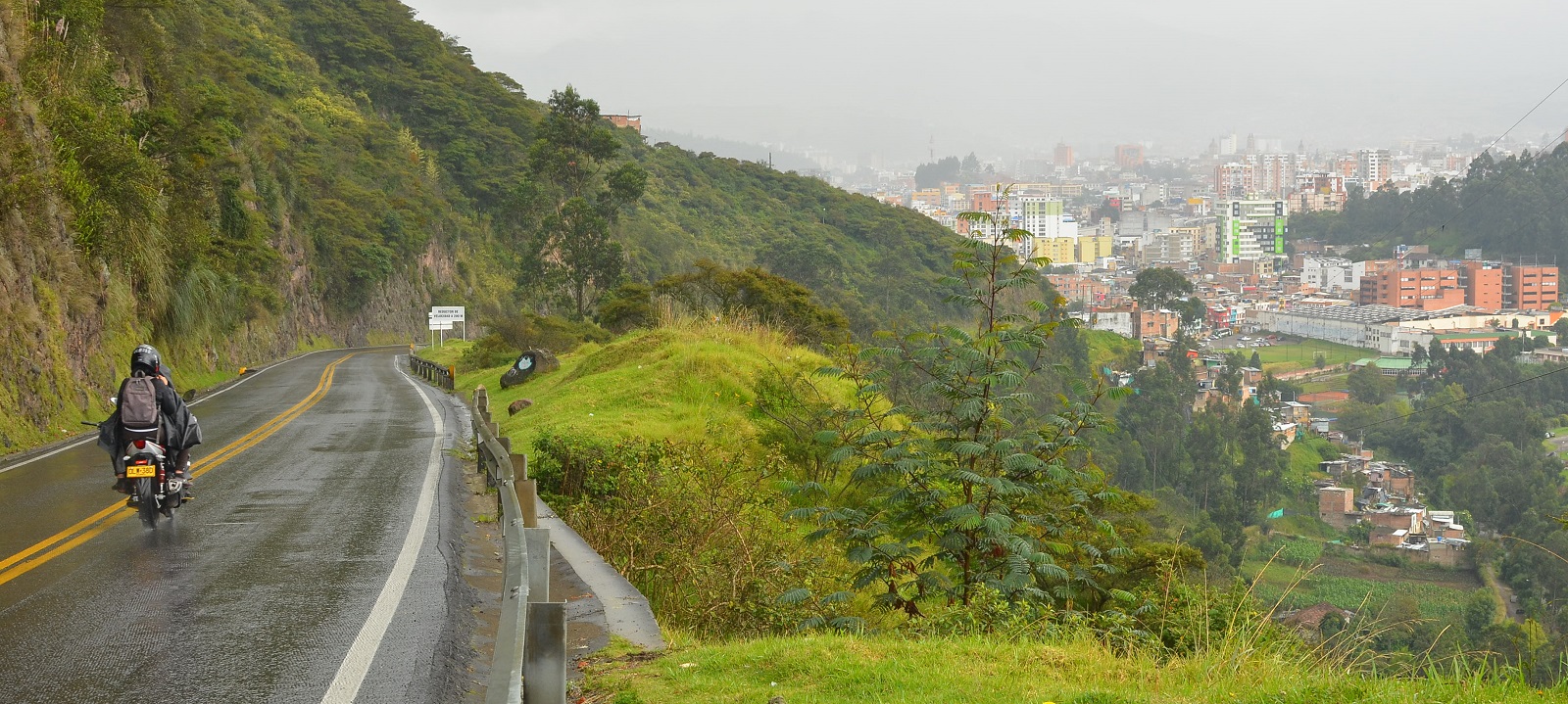
| The streets of Quito, Ecuador's capital. |
 |
| And another view. |